• USD
  • EUR
  • GBP
  • AUD
  • CAD
  • ZAR
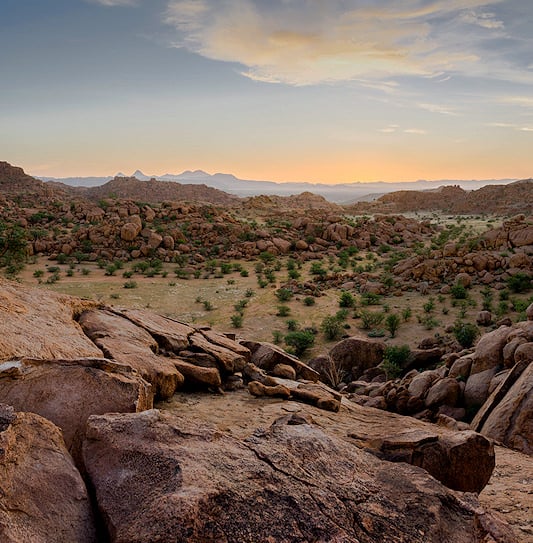
Massive granite boulders scattered across the rugged landscape of Damaraland at sunset.

Damaraland

Rock art, desert wildlife and vast landscapes in northwest Namibia.
Help Me Plan

Damaraland Destination Guide

Damaraland is a vast, rugged part of northwest Namibia. Dry riverbeds, rocky mountains and open plains support desert-adapted elephant and free-ranging black rhino. Twyfelfontein, Namibia’s first UNESCO World Heritage Site, preserves thousands of ancient rock engravings. The region also fits naturally into overland routes between Etosha and the Skeleton Coast.

Getting to Damaraland

By Air: Most visitors reach Damaraland by road, but fly-in itineraries are also possible. Light aircraft can use airstrips near selected lodges and Twyfelfontein, with road transfers completing the journey.

By Road: Damaraland fits naturally between Swakopmund, the Skeleton Coast and Etosha National Park. Routes from the coast can travel inland through Uis and the Twyfelfontein area, while travelers arriving from Etosha approach from the east. Most roads are gravel, so travel is best enjoyed at a relaxed pace.

Weather & Best Time to Visit

May to October is dry and generally cooler. These months are comfortable for touring, walking and wildlife tracking. Desert-adapted elephant and other animals also make greater use of dry riverbeds and reliable water sources.

November to April is hotter, with occasional summer rain. When rain falls, parts of Damaraland can turn surprisingly green. The region can be visited throughout the year, although midday heat can make summer activities more demanding.

Health Considerations

Malaria risk varies across northwest Namibia. Parts of Damaraland lie in Kunene Region, where malaria prevention is recommended. Travelers should seek current advice from a qualified healthcare professional before departure and use mosquito-bite precautions where appropriate. Check current health advice for Namibia before traveling.
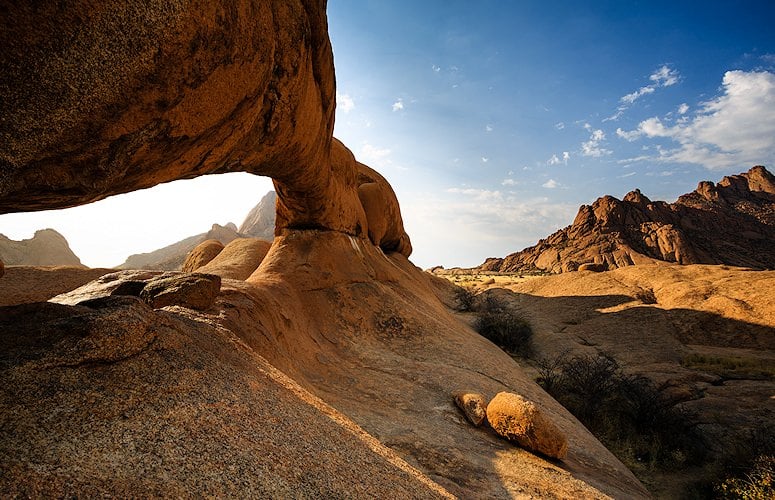
Twyfelfontein is one of Damaraland’s most important cultural sites and Namibia’s first UNESCO World Heritage Site. Thousands of rock engravings record the lives and beliefs of early hunter-gatherer communities. Other nearby attractions include the Petrified Forest and unusual geological formations. Farther south, the Brandberg rises to 2,573 m and is Namibia’s highest mountain.

Location
Northwest Namibia
UNESCO Site
Twyfelfontein (2007)
Rock Engravings
2,000+
Highest Point
Brandberg, 2,573 m
Signature Wildlife
Desert-adapted elephant, black rhino
Key Activities
Rock art and wildlife tracking
Cultural Heritage
Damara and San

Private Tours That Include Damaraland

These private Namibia tours include Damaraland as part of a wider itinerary. Both combine the region with Etosha, Swakopmund and other major highlights.
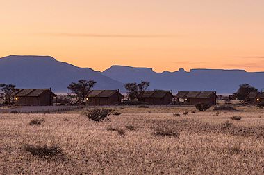
14 Day Namibia Private Overland Tour

From: USD 6,837 - 10,308 pp sharing Personal & National Park Camps Code: S41

Travel via Sossusvlei, Swakopmund and the Skeleton Coast to Damaraland before continuing across Etosha from west to east with a private guide.
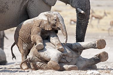
10 Day Northern Namibia Private Overland Tour

From: USD 5,578 - 7,924 pp sharing Personal & National Park Camps Code: S43

Follow the route from Swakopmund through the Skeleton Coast and Damaraland to Etosha on a private guided tour of northern Namibia.


TripadvisorTripadvisor
Rated 4.9/5 stars based on 175 reviews
★★★★★

Recommended Lodges

These are four African Sky favorites for stays in and around Damaraland.
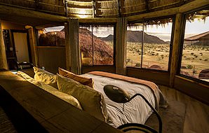
Camp Kipwe

Camp Kipwe blends into the granite boulders near Twyfelfontein.
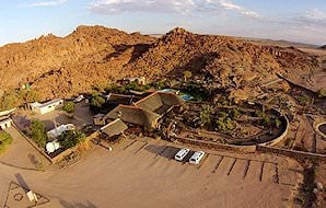
Brandberg White Lady Lodge

A laid-back base for exploring Brandberg and the surrounding desert.
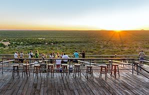
Damara Mopane Lodge

Comfortable accommodation near Khorixas with easy access to nearby sights.
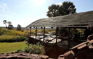
Palmwag Lodge

Palmwag Lodge is well placed for desert wildlife and rhino country.

View Namibia Lodges & Camps

Reasons to Visit Damaraland

1

Desert-Adapted Wildlife

Damaraland supports wildlife that survives in remarkably dry conditions. Desert-adapted elephant move through seasonal river systems. Free-ranging black rhino occur in the wider northwest. Sightings depend on conditions, which makes each encounter feel genuinely wild.

2

Rugged Landscapes

Rocky mountains, dry riverbeds and open plains define Damaraland. Granite formations and weathered valleys create striking scenery. Changing light brings out red, brown and gold tones across the landscape.

3

Ancient Rock Art

Twyfelfontein contains one of Africa’s most important concentrations of rock engravings. Guided walks reveal animals, tracks and human figures carved into the sandstone by hunter-gatherer communities over thousands of years.

Start Planning

Experiences to Savor

Damaraland combines ancient rock art, living cultural heritage and wildlife adapted to an exceptionally dry landscape.
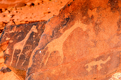
Twyfelfontein Rock Art

Guided walks at Twyfelfontein reveal thousands of engravings carved into sandstone surfaces. Animals, tracks and human figures provide a remarkable record of early hunter-gatherer life in this part of Namibia.
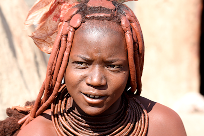
Damara Cultural Heritage

Damaraland takes its name from the Damara people. Local cultural visits offer insight into their history, language and traditions.
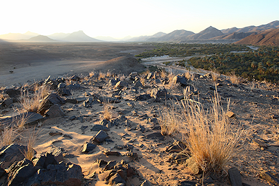
Tracking Desert Wildlife

Guided excursions search dry riverbeds and open country for desert-adapted wildlife. Elephant range widely in search of food and water. Some specialist excursions also focus on black rhino.

Useful Information

History

Damaraland takes its name from the Damara people, who have a long history in Namibia. Their traditional livelihoods included livestock keeping, hunting, gardening and metalworking. Today the name Damaraland remains widely used for this rugged part of northwest Namibia.

Human history in the region reaches much further back. Twyfelfontein preserves thousands of engravings created by San hunter-gatherers and became Namibia’s first UNESCO World Heritage Site in 2007. The Brandberg is another important rock-art area and is home to the well-known White Lady painting.

Wildlife

Damaraland supports wildlife adapted to some of Namibia’s driest conditions. Desert-adapted elephant move through seasonal river systems in search of food and water. The wider northwest also supports an important population of free-ranging black rhino. Giraffe, kudu, oryx, springbok and Hartmann’s mountain zebra also occur.

Predators include lion, cheetah, spotted hyena and brown hyena in parts of the wider region. Smaller animals include bat-eared foxes, rock hyrax and several desert-adapted reptiles. Birding can also be rewarding, particularly around dry riverbeds and rocky hills.

Vegetation & Terrain

Damaraland is shaped by rocky mountains, gravel plains and seasonal riverbeds. Vegetation is sparse, but trees and shrubs survive where underground water is available. The Brandberg dominates the southern part of the region and rises to 2,573 m, the highest point in Namibia.

Dry river systems are especially important for wildlife. They support patches of vegetation in an otherwise arid landscape and provide natural routes for animals moving through the region. The Petrified Forest near Khorixas preserves large fossilized tree trunks deposited by an ancient river system.

Conservation and Community

Much of northwest Namibia’s wildlife lives outside formal national parks, making communal conservancies an important part of conservation in the region. Local communities participate in wildlife management and can benefit from tourism linked to wildlife, landscapes and cultural heritage.

Conservancies such as Torra and ≠Khoadi-//Hôas were among Namibia’s first registered communal conservancies. This approach connects wildlife conservation with tourism and local livelihoods across the arid northwest.

The Petrified Forest and nearby geological attractions can be combined with a day of touring around Twyfelfontein. Damaraland is best explored slowly. Long distances, gravel roads and changing scenery are part of the experience rather than simply time spent between attractions.

Last Updated: August 17, 2026 Curated By: Riaan Viljoen