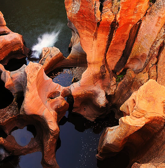
Bourke's Luck Potholes
Help Me PlanWhy Bourke’s Luck Potholes Belong on Your Panorama Route
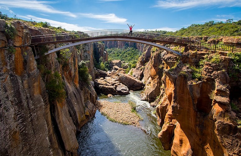
Set inside Blyde River Canyon Nature Reserve near the village of Moremela, this sculpted landscape marks the confluence of the Treur and Blyde Rivers. Over time, swirling water carved smooth, cylindrical “giant’s kettles” visible from railings and bridges. Short paths, clear viewpoints, and a small visitor area make it an easy stop to pair with nearby canyon lookouts.
Location
Blyde River Canyon Nature Reserve, Mpumalanga
Rivers
Confluence of the Treur and Blyde
Formation
Kolk/whirlpool erosion over millennia
Access
Short paths, bridges, fenced viewpoints
Distance
About 35 km north of Graskop
Fees
Modest per-person entry (SANParks/MTPA site)
Tips
Closed shoes; heed rails; surfaces can be slick
Coordinates
−24.6743, 30.8109 (marker accurate)